A customer calls dispatch and asks, “Where is my delivery?”
The dispatcher opens the tracking system and sees the truck on a map.
That answers the location question. But it does not necessarily answer the operational question.
Is the vehicle moving? Has it been stopped for 30 minutes? Is it following the planned route? Is the driver already at another customer location? Is the delivery running late?
For fleet operators, live map tracking becomes valuable when it provides this context around vehicle location. Instead of simply showing where a truck is, it helps operations teams understand what is happening during the trip and identify where attention may be required.
What is Live Map Tracking in Fleet Management?
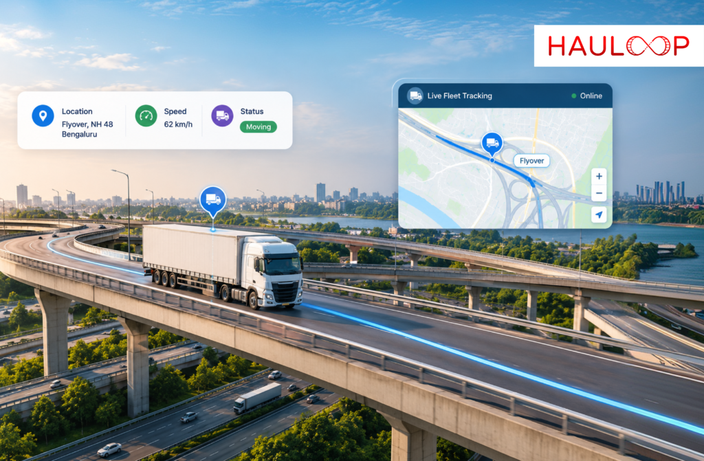
Live map tracking gives fleet operators a continuously updated view of vehicle location and movement on a connected map.
GPS location data flows from vehicles into the fleet platform, where operators can monitor their current position and movement status. Rather than working from the vehicle’s last reported location, teams can follow activity as the trip progresses.
For a fleet with multiple vehicles on the road, this creates one place to understand what is happening across active operations.
But location alone is only the starting point.
A useful live map should also help operators understand whether a vehicle is moving, stopped, idle, delayed, or progressing differently from the planned trip.
What does a Live Fleet Map Actually Show?
Imagine an operator managing 50 vehicles.
Looking at 50 vehicle icons does not automatically provide useful fleet visibility. The operator needs to know which vehicle requires attention.
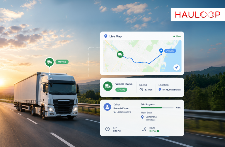
A live map can bring together information such as:
- Current vehicle location
- Real-time movement status
- Driver information
- Trip progress
- Stops and idling
- Route movement
- Delays or unusual activity
- Vehicle and trip status
Hauloop, for example, is designed to let operators click a vehicle and access driver, trip, location, stop, and movement information directly from the map.
This makes the map less about watching vehicles move and more about understanding what those vehicles are doing.
Why is Movement Status More Useful than Location Alone?
Suppose two trucks are shown five miles from their respective delivery locations.
Truck A is moving normally toward the customer.
Truck B has been stationary for 25 minutes at an unexpected location.
Their locations may look equally close to the destination, but their operational status is completely different.
Knowing whether a vehicle is moving, idle, or stopped gives the fleet operator more context. Hauloop’s live map functionality is specifically designed to surface these movement states rather than showing location alone.
This can help operators recognise a developing issue without immediately calling the driver for an explanation.
How can Live Map Tracking Help Identify Delays?
A delay rarely becomes useful information only when the delivery is officially late.
It often begins much earlier.
A vehicle spends longer than expected at one stop. Traffic slows its progress. The driver moves away from the expected route. An unscheduled stop extends for longer than normal.
If the operations team does not see these changes, the problem may only become visible when the customer asks where the delivery is.
With real-time fleet live tracking, operators can see delays, stops, route changes, and unusual movement while they are happening. Hauloop also provides live alerts around these types of events.
That gives the team an opportunity to investigate before a developing delay becomes a missed delivery commitment.
Does Live Map Tracking Reduce the Need to Call Drivers?
Driver communication will always remain important.
But drivers should not need to provide every routine location update manually.
Without sufficient tracking context, dispatchers may repeatedly ask:
“Where are you now?”
“Have you reached the customer?”
“Why have you stopped?”
“How far are you from the next delivery?”
Those calls take time for both the operations team and the driver.
When vehicle movement, trip progress, stops, and location context are available directly from the map, operators can answer many routine questions without interrupting the driver. Hauloop specifically addresses this problem by connecting vehicle, driver, and trip context within the live map.
The driver can focus on the road while dispatch focuses on exceptions that actually require communication.
How do Alerts Make Live Fleet Tracking More Useful?
A large fleet cannot expect an operator to watch every vehicle icon throughout the day.
The system needs to help identify what has changed.
Live tracking can surface events such as delays, prolonged stops, idling, route changes, or unusual activity.
Instead of manually checking every vehicle, the operator can focus on exceptions.
For example, if 47 vehicles are progressing normally and three show unusual activity, those three should receive attention first.
This changes the purpose of the map.
It is no longer:
“Show me all my vehicles.”
It becomes:
“Show me which vehicles need my attention.”
How do Filters Help When Managing a Large Fleet?
More vehicles can also mean more visual noise.
If dozens or hundreds of vehicles appear together, finding the right vehicle or operational issue can become difficult.
Fleet filters can help operators narrow the view according to location, movement, region, or trip status. Smart clustering can also make larger fleets easier to view without overcrowding the map.
An operator could therefore focus on vehicles within a particular region, vehicles currently stopped, or trips that require closer attention rather than reviewing the entire fleet at once.
Why does Driver and Trip Context Matter?
A stopped vehicle is not automatically a problem.
The truck could be completing a scheduled delivery, waiting at an approved location, or experiencing an unexpected delay.
Location tells you where the vehicle is.
Trip context helps explain what it is doing there.
When operators can access driver information, trip progress, stops, and movement behavior from the same map, they have more information to decide whether intervention is actually necessary. Hauloop brings these details into the vehicle view specifically to provide this operational context.
This prevents fleet teams from treating every stop as an exception.
What should Fleet Operators Expect from Live Map Tracking?
A fleet map should ultimately help operators make decisions faster.
It should allow the team to see current vehicle movement, understand trip progress, recognise unusual stops or delays, filter large numbers of vehicles, and access relevant driver and trip information without switching constantly between systems.
That is particularly important because fleet operations do not stop while someone investigates a problem.
The longer it takes to understand what is happening, the fewer options the operator may have to respond.
Live map tracking therefore becomes most useful when it moves the fleet through three stages:
See what is happening → Understand what needs attention → Take action.
That is considerably more valuable than simply knowing where a truck last reported from.
Conclusion
Live map tracking should not be treated as a digital map filled with vehicle icons.
Its real operational value comes from connecting location with movement, trip progress, driver information, stops, alerts, and other context. That allows fleet operators to distinguish normal activity from situations that may require attention.
For transport teams managing many active vehicles, the objective is not to watch every truck continuously. It is to recognise the right exception at the right time and respond before it creates a larger operational problem.
If your primary challenge is understanding what is happening across your fleet in real time, an AI Fleet Management Platform can bring vehicle movement, trip context, and operational alerts into one connected view. Book a demo with Hauloop to see how live map tracking works in practice.
Frequently Asked Questions
What is live map tracking in fleet management?
Live map tracking displays the current location and movement of fleet vehicles on a connected map, helping operators monitor active trips and identify changes as they happen.
What information can fleet operators see on a live map?
Depending on the platform, operators may see vehicle location, movement status, driver details, trip progress, stops, route activity, and relevant alerts.
How is live map tracking different from basic GPS tracking?
Basic GPS tracking primarily provides vehicle location. Live map tracking can add operational context such as whether the vehicle is moving or stopped, its trip progress, and events requiring attention.
Can live map tracking show when a vehicle is idle?
Yes. A fleet platform can use vehicle movement information to help operators distinguish between vehicles that are moving, stopped, or idle.
Can fleet operators track multiple vehicles on one map?
Yes. Hauloop supports multiple vehicles on a connected map and includes clustering and filtering capabilities to make larger fleets easier to monitor.
How can live map tracking improve fleet operations?
It can help teams identify delays and unusual activity earlier, reduce routine driver follow-ups, understand active trip progress, and focus attention on vehicles that require action.