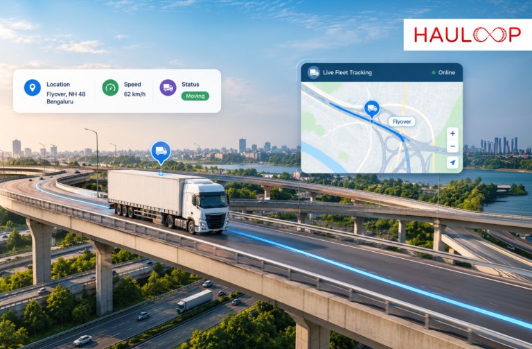
A vehicle appears on the map 20 miles from its next delivery.
That location sounds useful, but it leaves several important questions unanswered. Is the vehicle moving or stopped? How fast is it travelling? Is it progressing normally? Has it been stationary for longer than expected?
For fleet operators, location becomes far more useful when it is viewed alongside speed and vehicle status. Instead of checking separate systems or contacting drivers for routine updates, a live map can bring these signals together and provide a clearer picture of what each vehicle is doing on the road.
That is the practical value of live map tracking: not simply seeing where a vehicle is, but understanding its current movement in one operational view.
What does a Live Fleet Map Actually Bring Together?
Traditional vehicle tracking often begins with a GPS coordinate. The system receives location data from the vehicle and plots that position on a map.
Modern fleet operations need more context.
A dispatcher looking at an active vehicle may need to understand its current location, whether it is moving or stationary, how its trip is progressing, and whether anything unusual requires attention.
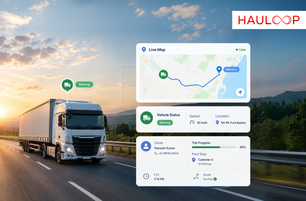
Hauloop’s live map is designed around this broader view. It brings real-time vehicle movement and status together while allowing operators to access driver, trip, and location details directly from the map.
The result is a more useful operational picture than a location pin alone.
How does Location Tell Fleet Operators Where the Vehicle is?
Location is the foundation of live tracking.
GPS data allows the fleet platform to place a vehicle on the map and continuously update its position as it travels. Hauloop receives live vehicle and GPS data and displays vehicles through one connected map view.
This helps operators answer basic questions quickly.
Has the truck left the depot? How far has it progressed? Is it near the customer? Which region is it currently operating in?
But location tells only part of the story.
Two vehicles could be displayed at almost identical distances from their destinations while operating very differently. One could be moving normally while the other has stopped unexpectedly.
That is why location needs to be interpreted alongside movement status.
What does Vehicle Status Add to the Map?
Vehicle status helps explain what is happening at the location shown.
Instead of seeing only a truck icon, operators can understand whether the vehicle is moving, stopped, or idle. Hauloop specifically provides real-time movement status within its live map functionality.
Consider a vehicle that has not changed position for 20 minutes.
Without status or trip context, the dispatcher may immediately assume there is a delay. But the vehicle could be completing a scheduled delivery or waiting at an expected stop.
If the same vehicle is stationary somewhere outside the planned operation, however, it may deserve attention.
Status gives location operational meaning.
Where does Speed Fit into Live Fleet Visibility?
Speed adds another layer to understanding vehicle movement.
Location tells the operator where the vehicle is, while movement information indicates whether it is progressing. Speed-related information can help the fleet understand how that movement is taking place.
For example, a truck may still be moving toward its destination but progressing unusually slowly. Another may be travelling in a way that raises a driver-safety concern.
This is why speed should not be treated as an isolated dashboard number.
When viewed alongside the vehicle’s location and current status, it becomes part of the wider trip picture. Operators can understand where the vehicle is, whether it is moving, and whether its movement deserves further attention.
For driver-safety analysis, repeated speeding behavior can then be reviewed separately from the live operational view.
Why is One Connected View Better Than Separate Updates?
Imagine a dispatcher managing 60 active vehicles.
If location is available in one system, trip information in another, and operational updates through driver calls or messages, understanding one vehicle can require several steps.
Now multiply that process across the fleet.
The problem is not necessarily a lack of data. It is that the information is scattered.
Hauloop’s live map allows operators to click a vehicle and access driver information, trip progress, stops, and movement behavior within the same environment.
This reduces the amount of searching required before an operator can understand what is happening.
A connected view can answer three immediate questions:
Where is it? → What is it doing? → Does it need attention?
That is much closer to how dispatch decisions are actually made.
How can Speed, Status and Location Reveal an Exception?
These data points become particularly useful when they are interpreted together.
Consider three vehicles.
Vehicle A is on the planned route, moving normally, and progressing toward its destination.
Vehicle B is also on the correct route but has remained stopped at an unexpected location.
Vehicle C is moving, but its route progress or movement behavior appears unusual.
Location alone might show all three vehicles somewhere between origin and destination. Adding status and movement information helps the operator distinguish routine trips from potential exceptions.
The fleet team does not need to treat every active vehicle as a problem.
It can focus on the vehicles whose current activity differs from what is expected.
How do Live Alerts Help Operators Notice Changes?
Even with all the right information on a map, operators cannot spend the entire day watching every vehicle.
This becomes especially difficult as fleet size increases.
Live tracking helps bring exceptions to the operator rather than expecting the operator to continuously search for them.
Hauloop can surface real-time alerts for delays, idling, route changes, and unusual activity.
For example, an operator may not need to continuously watch a vehicle that is progressing normally. If that vehicle stops unexpectedly or its trip movement changes, the system can make the change easier to identify.
This creates a more practical workflow:
Monitor normally → Detect a change → Review the context → Take action if required.
How do Filters Make a Live Map Easier to Manage?
Putting every fleet vehicle on one screen can create another problem: too much information.
A fleet with dozens or hundreds of vehicles needs a way to narrow the view.
Hauloop includes smart clustering along with filters based on factors such as region, location, movement, and trip status.
Instead of scanning the entire fleet, an operator can focus on a relevant group.
For example, they may want to view vehicles in one operating region or focus on vehicles with a particular movement status.
The map then becomes a working operations tool rather than a crowded display of vehicle icons.
How does this Reduce Routine Driver Follow-Ups?
Without enough live context, dispatchers often depend on drivers to explain what is happening.
“Where are you?”
“Are you moving again?”
“Have you reached the customer?”
“Why have you stopped?”
Some communication will always be necessary, particularly when an operational issue requires explanation or action. But routine status checks do not always need a phone call.
Hauloop’s live map is designed to combine vehicle, driver, trip, stop, and movement information so operators can understand more of the situation directly.
This allows driver communication to focus more on exceptions that actually require human input.
Why does this Matter for Day-to-Day Fleet Decisions?
The real benefit of combining location, speed-related movement, and status is not having more data.
It is reducing the time between seeing a change and understanding what it means.
If an operator sees that a vehicle has stopped unexpectedly, they can review its location and trip context. If movement suggests a developing delay, the team can investigate before the delivery window is missed. If unusual activity appears, the operator can determine whether the driver needs to be contacted.
Hauloop positions its live map around exactly this progression: bringing live vehicle information into one map, providing context and alerts, and helping teams move toward faster operational action.
That is what makes live tracking operationally useful.
Conclusion
A vehicle’s location answers where.
Its status helps explain what it is doing.
Its movement and speed-related information add context around how it is progressing.
Bringing those signals together gives fleet operators a much clearer understanding of what is happening across active trips. Instead of watching dots on a map or chasing routine driver updates, teams can focus on vehicles and situations that actually require attention.
If your primary challenge is bringing location, movement status, speed-related activity, and trip context into one operational view, an AI Fleet Management Platform can make live fleet information easier to understand and act on. Book a demo with Hauloop to see how live map tracking works in practice.
Frequently Asked Questions
What information does live map tracking show?
Live map tracking can show real-time vehicle location and movement status while providing access to relevant driver, trip, stop, and location context.
Can a live fleet map show whether a vehicle is moving or stopped?
Yes. Hauloop's live map provides real-time movement status so operators can identify whether vehicles are moving, idle, or stopped.
Why should speed and location be viewed together?
Location shows where a vehicle is, while speed-related movement information helps operators understand how it is progressing. Together, they provide more context than a GPS position alone.
Can live map tracking identify delays?
It can help operators recognise changes such as stops, idling, route changes, and unusual activity while trips are underway.
How does live map tracking help large fleets?
Smart clustering and filtering can help operators narrow the map according to location, movement, region, or trip status rather than reviewing every vehicle individually.
Does live tracking replace communication with drivers?
No. Driver communication remains important for situations requiring explanation or action. Live tracking can reduce unnecessary routine status calls by giving operators access to vehicle and trip context directly from the map.